Pea Ridge
City in Benton County, Arkansas
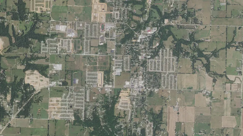
Pea Ridge is a city in Benton County, Arkansas, with 6,559 residents (2020 Census). It sits at 1,289 ft (393 m) above sea level. The nearest town is Little Flock, 4.5 miles S.
- 6,559residents (2020 Census)
- 1,289 ftelevation · 393 m
- 8.6 sq miland area · 22.4 km²
- 759 / sq mipopulation density
- 72751ZIP code
About Pea Ridge
Pea Ridge is a city in Benton County, Arkansas, United States. The name Pea Ridge is derived from a combination of the physical location of the original settlement of the town, across the crest of a ridge of the Ozark Mountains, and for the hog peanuts or turkey peas that had been originally cultivated by Native American tribes centuries before European settlement, which later helped to provide basic subsistence once those pioneer settlers arrived.
The rural town is best known as the location of the pivotal American Civil War engagement the Battle of Pea Ridge, or, as it is locally known, the Battle of Elkhorn Tavern, which took place approximately 5 miles (8 km) east of the town. The site of the battle is preserved as the Pea Ridge National Military Park.
The town's downtown business district is on the National Register of Historic Places and largely comprises commercial structures from the late 19th and early 20th centuries. The population of Pea Ridge was 6,559 as of the 2020 census. It is part of the Northwest Arkansas region. The local weekly newspaper is the Times of Northeast Benton County.
Text: Wikipedia · CC BY-SA 4.0
Pea Ridge weather: 7-day forecast
Loading the National Weather Service forecast…
Source: National Weather Service (NOAA).
Live webcams in Pea Ridge
Webcams: Windy.com
Living in Pea Ridge
- Median household income
- $95,521
- Median home value
- $297,500
- Median rent
- $1,818/mo
- Median age
- 33.4
Do you know Pea Ridge? Tell us about it
Help other travelers: share what makes Pea Ridge special. We review every message before publishing it.
Map of Pea Ridge
Tap any street on the map to see it in Street View below. Map: © OpenStreetMap contributors.
Pea Ridge Street View
Drag the image to look around and tap the arrows on the ground to move. If it says there is no imagery, tap a nearby street on the map above.
Open in Google Maps ›Pea Ridge, AR population
Pea Ridge had 6,559 residents in the 2020 Census.
| 2020 Census | 6,559 |
|---|---|
| Density | 759 per sq mi (293 per km²) |
Source: U.S. Census Bureau, Decennial Census.
Pea Ridge at a glance
| State | Arkansas (AR) |
|---|---|
| County | Benton County |
| Type | City |
| Population | 6,559 (2020) |
| Land area | 8.65 sq mi (22.4 km²) |
| Water area | 0.00 sq mi (0.01 km²) |
| Elevation | 1,289 ft (393 m) |
| Coordinates | 36.4467° N, 94.1208° W |
| ZIP code | 72751 |
| Official website | pea-ridge-ar.com |
| Census code (GEOID) | 0554200 |
Sources: U.S. Census Bureau (Gazetteer, ZCTA), USGS GNIS, Wikidata.
Towns near Pea Ridge
- Little Flock4.5 mi S
- Avoca4.7 mi SE
- Garfield7.9 mi E
- Bella Vista8.2 mi W
- Prairie Creek8.8 mi SE
- Bentonville9.0 mi SW
- Rogers9.1 mi S
- Gateway10.8 mi E
- Seligman, MO11.4 mi NE
- Centerton11.7 mi SW
- Lost Bridge Village12.1 mi E
- Jane, MO12.2 mi NW
Straight-line distance between town centers.
Frequently asked questions about Pea Ridge
What county is Pea Ridge in?
Pea Ridge is in Benton County, Arkansas.
What is the population of Pea Ridge, AR?
6,559 people lived in Pea Ridge at the 2020 Census.
What is the ZIP code of Pea Ridge, AR?
The ZIP code of Pea Ridge is 72751.
What is the elevation of Pea Ridge?
1,289 feet (393 m) above sea level.
What towns are near Pea Ridge?
Little Flock (4.5 mi), Avoca (4.7 mi), Garfield (7.9 mi), Bella Vista (8.2 mi), Prairie Creek (8.8 mi).
Last updated: