Hot Springs
City in Garland County, Arkansas
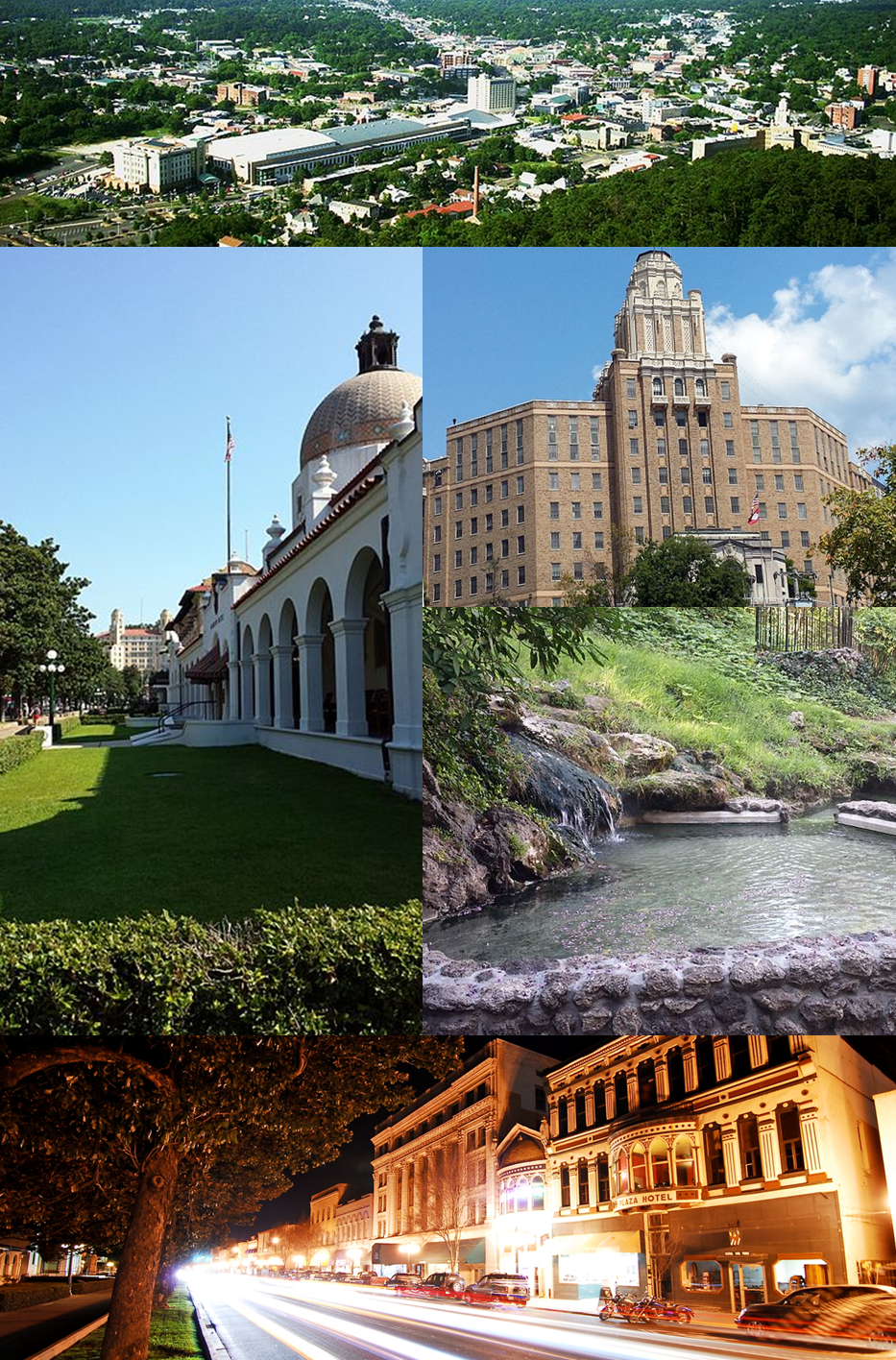
Hot Springs is a city in Garland County, Arkansas, with 37,930 residents (2020 Census). It sits at 597 ft (182 m) above sea level. The nearest town is Lake Hamilton, 4.4 miles S.
- 37,930residents (2020 Census)
- 597 ftelevation · 182 m
- 37.6 sq miland area · 97.3 km²
- 1,010 / sq mipopulation density
- 71913ZIP code
About Hot Springs
Hot Springs is a resort city in the state of Arkansas, United States, and the county seat of Garland County. The city is located in the Ouachita Mountains among the U.S. Interior Highlands, and is set among several natural hot springs for which the city is named. As of the 2020 United States census, the city had a population of 37,930, making it the eleventh-most populous city in Arkansas.
The center of Hot Springs is the oldest federal reserve in the United States, today preserved as Hot Springs National Park. The hot spring water has been popularly believed for centuries to possess healing properties, and was a subject of legend among several Native American tribes. Following federal protection in 1832, the city developed into a successful spa town. Incorporated January 10, 1851, the city has been home to Major League Baseball spring training, illegal gambling, speakeasies, and gangsters such as Al Capone, Charles "Lucky" Luciano, Frank Costello, and Bugs Moran. It also features the childhood home of the 42nd U.S. President, Bill Clinton. One of the largest Pentecostal denominations in the United States, the Assemblies of God, traces its beginnings to Hot Springs, as do horse racing at Oaklawn Park and the Army and Navy Hospital.
Much of Hot Springs' history is preserved by various government entities. Hot Springs National Park is maintained by the National Park Service and includes Bathhouse Row, which preserves the eight historic bathhouse buildings and gardens along Central Avenue. Downtown Hot Springs is preserved as the Central Avenue Historic District, listed on the National Register of Historic Places. The city also contains dozens of historic hotels and motor courts, built during the Great Depression in the Art Deco style. Due to the popularity of the thermal waters, Hot Springs benefited from rapid growth during a period when many cities saw a sharp decline in building—much like Miami's Art Deco districts. As a result, Hot Springs's architecture is a key part of the city's blend of cultures, including a reputation as a tourist town and a Southern city. Also a destination for the arts, Hot Springs hosts the Hot Springs Music Festival, Hot Springs Documentary Film Festival, and the Valley of the Vapors Independent Music Festival.
Text: Wikipedia · CC BY-SA 4.0
Hot Springs weather: 7-day forecast
Loading the National Weather Service forecast…
Source: National Weather Service (NOAA).
Live webcams in Hot Springs
Webcams: Windy.com
Living in Hot Springs
- Median household income
- $47,760
- Median home value
- $165,500
- Median rent
- $914/mo
- Median age
- 45.3
Do you know Hot Springs? Tell us about it
Help other travelers: share what makes Hot Springs special. We review every message before publishing it.
Map of Hot Springs
Tap any street on the map to see it in Street View below. Map: © OpenStreetMap contributors.
Hot Springs Street View
Drag the image to look around and tap the arrows on the ground to move. If it says there is no imagery, tap a nearby street on the map above.
Open in Google Maps ›Hot Springs, AR population
Hot Springs had 37,930 residents in the 2020 Census.
| 2020 Census | 37,930 |
|---|---|
| Density | 1,010 per sq mi (390 per km²) |
Source: U.S. Census Bureau, Decennial Census.
Hot Springs at a glance
| State | Arkansas (AR) |
|---|---|
| County | Garland County |
| Type | City |
| Population | 37,930 (2020) |
| Land area | 37.56 sq mi (97.3 km²) |
| Water area | 0.12 sq mi (0.31 km²) |
| Elevation | 597 ft (182 m) |
| Coordinates | 34.4894° N, 93.0503° W |
| ZIP code | 71913 |
| Official website | cityhs.net |
| Census code (GEOID) | 0533400 |
Sources: U.S. Census Bureau (Gazetteer, ZCTA), USGS GNIS, Wikidata.
Towns near Hot Springs
- Lake Hamilton4.4 mi S
- Rockwell5.1 mi W
- Piney5.4 mi W
- Diamondhead6.3 mi SE
- Mountain Pine8.7 mi NW
- Jones Mills9.0 mi E
- Fountain Lake11.1 mi NE
- Magnet Cove12.4 mi E
- Hot Springs Village12.6 mi N
- Bismarck13.7 mi SW
- Pearcy14.1 mi W
- Lonsdale14.2 mi E
Straight-line distance between town centers.
Frequently asked questions about Hot Springs
What county is Hot Springs in?
Hot Springs is in Garland County, Arkansas.
What is the population of Hot Springs, AR?
37,930 people lived in Hot Springs at the 2020 Census.
What is the ZIP code of Hot Springs, AR?
The ZIP code of Hot Springs is 71913.
What is the elevation of Hot Springs?
597 feet (182 m) above sea level.
What towns are near Hot Springs?
Lake Hamilton (4.4 mi), Rockwell (5.1 mi), Piney (5.4 mi), Diamondhead (6.3 mi), Mountain Pine (8.7 mi).
Last updated: