Red Rock
Census-designated place in Apache County, Arizona
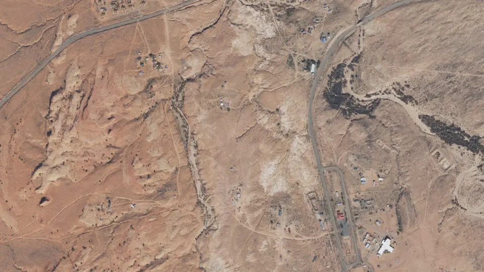
Red Rock is an unincorporated community (census-designated place) in Apache County, Arizona, with 136 residents (2020 Census). It sits at 1,870 ft (570 m) above sea level. The nearest town is Lukachukai, 15.9 miles SW.
- 136residents (2020 Census)
- 1,870 ftelevation · 570 m
- 1.2 sq miland area · 3.0 km²
- 117 / sq mipopulation density
- 86544ZIP code
About Red Rock
Red Rock is a census-designated place (CDP) in South-Central Pinal County, Arizona, United States, located along Interstate 10. As of the 2020 census, it had a population of 2,625.
The elevation is 1,865 feet (568 m), according to the water tower.
Mostly agricultural land until recent times, it is now starting to acquire some tract home communities.
The area also consists of large sections of undeveloped Sonoran Desert. Picacho Peak State Park is located about six miles northwest of Red Rock.
Red Rock also has a school called Red Rock Elementary school which goes from kindergarten through eighth grade.
Also home to the Saguaro Power Plant and the Saguaro Solar Power Station - a 1 MW solar trough concentrating power plant, both of which are owned by Arizona Public Service (APS).
ASU has contracted with APS to develop and operate a 29 MWdc solar facility at APS's Saguaro Generating Station near Red Rock, AZ. With the addition of this project to ASU's existing project portfolio, ASU will have driven the development of solar energy production beyond the 50MWdc milestone. As part of the transaction, APS will supply ASU with 65,000 MWh per year of solar energy, an increase of more than 150% above the current renewable energy used by the university.
Red Rock has a ZIP Code of 85245; in 2000, the population of the 85245 ZCTA was 332. Another zip code of 85145 was added.
Many homes in the area were built by PulteGroup.
Text: Wikipedia · CC BY-SA 4.0
Red Rock weather: 7-day forecast
Loading the National Weather Service forecast…
Source: National Weather Service (NOAA).
Nearest webcams to Red Rock
There are no webcams in Red Rock itself. These are the closest, 49 miles away or more.
Webcams: Windy.com
Living in Red Rock
- Median household income
- $40,000
- Median home value
- $56,300
- Median age
- 60.8
Do you know Red Rock? Tell us about it
Help other travelers: share what makes Red Rock special. We review every message before publishing it.
Map of Red Rock
Tap any street on the map to see it in Street View below. Map: © OpenStreetMap contributors.
Red Rock Street View
Drag the image to look around and tap the arrows on the ground to move. If it says there is no imagery, tap a nearby street on the map above.
Open in Google Maps ›Red Rock, AZ population
Red Rock had 136 residents in the 2020 Census.
| 2020 Census | 136 |
|---|---|
| Density | 117 per sq mi (45 per km²) |
Source: U.S. Census Bureau, Decennial Census.
Red Rock at a glance
| State | Arizona (AZ) |
|---|---|
| County | Apache County |
| Type | Census-designated place |
| Population | 136 (2020) |
| Land area | 1.17 sq mi (3.0 km²) |
| Water area | 0.00 sq mi (0.00 km²) |
| Elevation | 1,870 ft (570 m) |
| Coordinates | 36.6011° N, 109.0645° W |
| ZIP code | 86544 |
| Census code (GEOID) | 0459690 |
Sources: U.S. Census Bureau (Gazetteer, ZCTA), USGS GNIS, Wikidata.
Towns near Red Rock
- Lukachukai15.9 mi SW
- Sanostee, NM16.3 mi SE
- Beclabito, NM16.4 mi N
- Tsaile22.3 mi S
- Teec Nos Pos23.0 mi N
- Round Rock23.1 mi W
- Sehili23.1 mi S
- Shiprock, NM24.3 mi NE
- Newcomb, NM29.3 mi SE
- Red Mesa30.6 mi NW
- Rock Point31.5 mi W
- Del Muerto35.3 mi SW
Straight-line distance between town centers.
Frequently asked questions about Red Rock
What county is Red Rock in?
Red Rock is in Apache County, Arizona.
What is the population of Red Rock, AZ?
136 people lived in Red Rock at the 2020 Census.
What is the ZIP code of Red Rock, AZ?
The ZIP code of Red Rock is 86544.
What is the elevation of Red Rock?
1,870 feet (570 m) above sea level.
What towns are near Red Rock?
Lukachukai (15.9 mi), Sanostee (16.3 mi), Beclabito (16.4 mi), Tsaile (22.3 mi), Teec Nos Pos (23.0 mi).
Last updated: