Mormon Lake
Census-designated place in Coconino County, Arizona
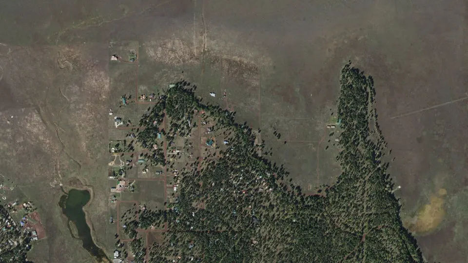
Mormon Lake is an unincorporated community (census-designated place) in Coconino County, Arizona, with 90 residents (2020 Census). It sits at 7,146 ft (2,178 m) above sea level. The nearest town is Munds Park, 10.4 miles W.
- 90residents (2020 Census)
- 7,146 ftelevation · 2,178 m
- 1.4 sq miland area · 3.6 km²
- 65 / sq mipopulation density
- 86038ZIP code
About Mormon Lake
Mormon Lake is a populated place situated in Coconino County, Arizona, south of the eponymous lake. It has an estimated elevation of 7,146 feet (2,178 m) above sea level.
Mormon Lake, and nearby Lakeview, were developed along Mormon Lake during wetter years when the lake was higher. Various homes have docks far from the current shoreline. This community is built around Mormon Lake Lodge, which originally was on the lake, but now relies on a fishing pond located adjacent to the Lodge.
Although at times confused with the neighboring community of Lakeview, a 1966 GNIS Board Decision clarified that they are separate, distinct communities, located one mile apart. The question has recently become more difficult as Mormon Lake has a post office, while Lakeview does not, thus Lakeview residents have a Mormon Lake address.
Text: Wikipedia · CC BY-SA 4.0
Mormon Lake weather: 7-day forecast
Loading the National Weather Service forecast…
Source: National Weather Service (NOAA).
Live webcams in Mormon Lake
Webcams: Windy.com
Do you know Mormon Lake? Tell us about it
Help other travelers: share what makes Mormon Lake special. We review every message before publishing it.
Map of Mormon Lake
Tap any street on the map to see it in Street View below. Map: © OpenStreetMap contributors.
Mormon Lake Street View
Drag the image to look around and tap the arrows on the ground to move. If it says there is no imagery, tap a nearby street on the map above.
Open in Google Maps ›Mormon Lake, AZ population
Mormon Lake had 90 residents in the 2020 Census.
| 2020 Census | 90 |
|---|---|
| Density | 65 per sq mi (25 per km²) |
Source: U.S. Census Bureau, Decennial Census.
Mormon Lake at a glance
| State | Arizona (AZ) |
|---|---|
| County | Coconino County |
| Type | Census-designated place |
| Population | 90 (2020) |
| Land area | 1.39 sq mi (3.6 km²) |
| Water area | 0.01 sq mi (0.01 km²) |
| Elevation | 7,146 ft (2,178 m) |
| Coordinates | 34.9116° N, 111.4481° W |
| ZIP code | 86038 |
| Census code (GEOID) | 0447680 |
Sources: U.S. Census Bureau (Gazetteer, ZCTA), USGS GNIS, Wikidata.
Towns near Mormon Lake
- Munds Park10.4 mi W
- Mountainaire16.8 mi NW
- Oak Creek Canyon17.3 mi W
- Kachina Village18.8 mi NW
- Village of Oak Creek (Big Park)19.9 mi SW
- Sedona21.3 mi W
- Flagstaff21.3 mi NW
- Mountain View Ranches22.3 mi N
- Doney Park24.8 mi N
- Blue Ridge26.9 mi SE
- Lake Montezuma27.6 mi SW
- Timberline-Fernwood28.6 mi N
Straight-line distance between town centers.
Frequently asked questions about Mormon Lake
What county is Mormon Lake in?
Mormon Lake is in Coconino County, Arizona.
What is the population of Mormon Lake, AZ?
90 people lived in Mormon Lake at the 2020 Census.
What is the ZIP code of Mormon Lake, AZ?
The ZIP code of Mormon Lake is 86038.
What is the elevation of Mormon Lake?
7,146 feet (2,178 m) above sea level.
What towns are near Mormon Lake?
Munds Park (10.4 mi), Mountainaire (16.8 mi), Oak Creek Canyon (17.3 mi), Kachina Village (18.8 mi), Village of Oak Creek (Big Park) (19.9 mi).
Last updated: