Naukati Bay
Census-designated place in Prince of Wales-Hyder Census Area, Alaska
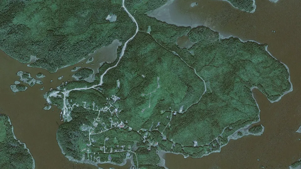
Naukati Bay is an unincorporated community (census-designated place) in Prince of Wales-Hyder Census Area, Alaska, with 142 residents (2020 Census). It sits at 207 ft (63 m) above sea level. The nearest town is Whale Pass, 15.2 miles N.
- 142residents (2020 Census)
- 207 ftelevation · 63 m
- 4.8 sq miland area · 12.4 km²
- 30 / sq mipopulation density
About Naukati Bay
Naukati Bay (Lingít: Nàakig̱èey) is a census-designated place (CDP) in the Prince of Wales-Hyder Census Area of the Unorganized Borough of the U.S. state of Alaska. The population was 142 at the 2020 census.
Also known as Naukati or Naukati West, the community lies approximately 30 miles (48 km) north of Craig and 20 miles (32 km) southwest of Coffman Cove on Prince of Wales Island, within the Unorganized Borough. Naukati Bay Subdivision East and West are located on the east side of Tuxekan Passage in Naukati Bay. The community of Naukati Bay has developed over the past 30 years from its original logging camp status to an independent community. Primary local access is via unpaved gravel logging roads. The area was extensively clear cut over the past 30 years, and the resulting regrowth is quite dense. Vegetation is typical temperate rain forest.
Text: Wikipedia · CC BY-SA 4.0
Naukati Bay weather: 7-day forecast
Loading the National Weather Service forecast…
Source: National Weather Service (NOAA).
Live webcams in Naukati Bay
Webcams: Windy.com
Do you know Naukati Bay? Tell us about it
Help other travelers: share what makes Naukati Bay special. We review every message before publishing it.
Map of Naukati Bay
Tap any street on the map to see it in Street View below. Map: © OpenStreetMap contributors.
Naukati Bay Street View
Drag the image to look around and tap the arrows on the ground to move. If it says there is no imagery, tap a nearby street on the map above.
Open in Google Maps ›Naukati Bay, AK population
Naukati Bay had 142 residents in the 2020 Census.
| 2020 Census | 142 |
|---|---|
| Density | 30 per sq mi (11 per km²) |
Source: U.S. Census Bureau, Decennial Census.
Naukati Bay at a glance
| State | Alaska (AK) |
|---|---|
| County | Prince of Wales-Hyder Census Area |
| Type | Census-designated place |
| Population | 142 (2020) |
| Land area | 4.79 sq mi (12.4 km²) |
| Water area | 0.30 sq mi (0.78 km²) |
| Elevation | 207 ft (63 m) |
| Coordinates | 55.8747° N, 133.1958° W |
| Census code (GEOID) | 0252845 |
Sources: U.S. Census Bureau (Gazetteer, ZCTA), USGS GNIS, Wikidata.
Towns near Naukati Bay
- Whale Pass15.2 mi N
- Coffman Cove16.5 mi NE
- Edna Bay20.3 mi W
- Klawock22.0 mi S
- Craig26.9 mi S
- Thorne Bay29.3 mi SE
- Hollis31.4 mi SE
- Port Protection35.3 mi NW
- Point Baker36.5 mi NW
- Hydaburg48.5 mi S
Straight-line distance between town centers.
Frequently asked questions about Naukati Bay
What county is Naukati Bay in?
Naukati Bay is in Prince of Wales-Hyder Census Area, Alaska.
What is the population of Naukati Bay, AK?
142 people lived in Naukati Bay at the 2020 Census.
What is the elevation of Naukati Bay?
207 feet (63 m) above sea level.
What towns are near Naukati Bay?
Whale Pass (15.2 mi), Coffman Cove (16.5 mi), Edna Bay (20.3 mi), Klawock (22.0 mi), Craig (26.9 mi).
Last updated: