Nabesna
Census-designated place in Copper River Census Area, Alaska
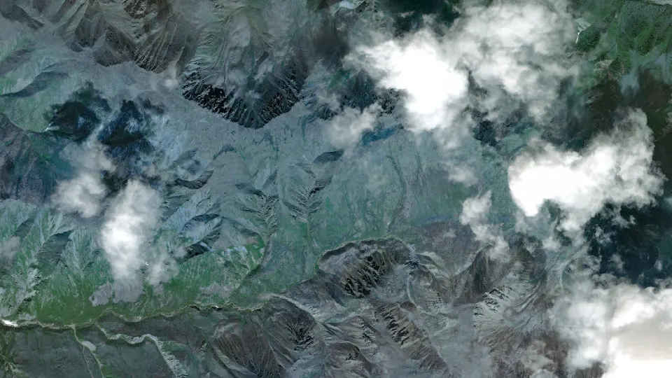
Nabesna is an unincorporated community (census-designated place) in Copper River Census Area, Alaska, with 2 residents (2020 Census). It sits at 2,979 ft (908 m) above sea level. The nearest town is Slana, 15.9 miles NW.
- 2residents (2020 Census)
- 2,979 ftelevation · 908 m
- 160.3 sq miland area · 415.1 km²
- 0 / sq mipopulation density
About Nabesna
Nabesna (Nabaesna’ in Ahtna; Naambia Niign Daacheeg in Upper Tanana) is a census-designated place and unincorporated community in northern Copper River Census Area, Alaska, United States, in the northern part of the Wrangell-St. Elias National Park and Preserve. It lies along the Nabesna Road, a gravel road that connects it to the Tok Cut-Off at Slana. Its elevation is 2,979 feet (908 m). Founded by and named for the Nabesna Mining Company, the community received a post office in 1909. Located at the base of White Mountain in the Wrangell Mountains, it lies west of the Nabesna River. As of the 2020 census, Nabesna had a population of 2.
Gold was discovered at White Mountain in 1891, and the site was first developed in the early 20th century. Through the efforts of Carl Whitham, the Nabesna Mining Company was formed in 1929, resulting in an expansion of the camp and the construction of Nabesna Road. The mine was closed during World War II, and only briefly reopened afterward, closing permanently after Whitham died in 1947. The location was used as a secret supply cache by the United States Army during the Cold War. The mine produced 2.5 short tons (2.3 t) of gold during its active period, as well as many tons of silver, copper, and lead.
The old mining camp, now a ghost town, and the mine were listed as the Nabesna Gold Mine Historic District on the National Register of Historic Places in 1979.
Text: Wikipedia · CC BY-SA 4.0
Nabesna weather: 7-day forecast
Loading the National Weather Service forecast…
Source: National Weather Service (NOAA).
Nearest webcams to Nabesna
There are no webcams in Nabesna itself. These are the closest, 35 miles away or more.
Webcams: Windy.com
Do you know Nabesna? Tell us about it
Help other travelers: share what makes Nabesna special. We review every message before publishing it.
Map of Nabesna
Tap any street on the map to see it in Street View below. Map: © OpenStreetMap contributors.
Nabesna Street View
Drag the image to look around and tap the arrows on the ground to move. If it says there is no imagery, tap a nearby street on the map above.
Open in Google Maps ›Nabesna, AK population
Nabesna had 2 residents in the 2020 Census.
| 2020 Census | 2 |
|---|---|
| Density | 0 per sq mi (0 per km²) |
Source: U.S. Census Bureau, Decennial Census.
Nabesna at a glance
| State | Alaska (AK) |
|---|---|
| County | Copper River Census Area |
| Type | Census-designated place |
| Population | 2 (2020) |
| Land area | 160.26 sq mi (415.1 km²) |
| Water area | 0.56 sq mi (1.45 km²) |
| Elevation | 2,979 ft (908 m) |
| Coordinates | 62.4961° N, 143.0078° W |
| Census code (GEOID) | 0251960 |
Sources: U.S. Census Bureau (Gazetteer, ZCTA), USGS GNIS, Wikidata.
Towns near Nabesna
Straight-line distance between town centers.
Frequently asked questions about Nabesna
What county is Nabesna in?
Nabesna is in Copper River Census Area, Alaska.
What is the population of Nabesna, AK?
2 people lived in Nabesna at the 2020 Census.
What is the elevation of Nabesna?
2,979 feet (908 m) above sea level.
What towns are near Nabesna?
Slana (15.9 mi), Mentasta Lake (39.7 mi), Chisana (40.7 mi).
Last updated: