Abney Crossroads
Census-designated place in Kershaw County, South Carolina
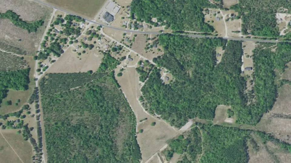
Abney Crossroads is an unincorporated community (census-designated place) in Kershaw County, South Carolina, with 101 residents (2020 Census). It sits at 404 ft (123 m) above sea level. The nearest town is Kershaw, 5.0 miles NW.
- 101residents (2020 Census)
- 404 ftelevation · 123 m
- 0.5 sq miland area · 1.2 km²
- 222 / sq mipopulation density
- 29067ZIP code
About Abney Crossroads
Abney Crossroads is an unincorporated community and census-designated place (CDP) in Kershaw County, South Carolina, United States. It was first listed as a CDP prior to the 2020 census.
The CDP is in northern Kershaw County, along South Carolina Highway 341, which leads northwest 5 miles (8 km) to Kershaw and southeast 12 miles (19 km) to Bethune.
Text: Wikipedia · CC BY-SA 4.0
Abney Crossroads weather: 7-day forecast
Loading the National Weather Service forecast…
Source: National Weather Service (NOAA).
Live webcams in Abney Crossroads
Webcams: Windy.com
Things to do in Abney Crossroads
Top places to visit in and around Abney Crossroads: Goodale State Park, Camden Battlefield and Matson Street Historic District.
 Goodale State ParkState park · 15 mi S
 Camden BattlefieldBattlefield · 12 mi SW
 Matson Street Historic DistrictHistoric district · 5.1 mi NWBattle of Hanging Rock Historic SiteBattlefield · 9.5 mi W
Museums & galleries (1)Historic sites & landmarks (10)Parks & gardens (9)Waterfalls (1)Scenic viewpoints & peaks (2)Nature reserves & natural wonders (3)Theaters & public art (2)
All 28 things to do in Abney Crossroads ›Small communities near Abney Crossroads
Natural hazards in Kershaw County
FEMA rates the overall natural hazard risk of Kershaw County (where Abney Crossroads is) as relatively low (score 66.7 out of 100, compared with all U.S. counties). The highest risks are from strong winds, ice storms.
| Hazard | Risk | Score | Events per year |
|---|---|---|---|
| Strong wind | Relatively High | 86.4 | 5.3 |
| Hurricane | Relatively Moderate | 86.1 | 0.2 |
| Ice storm | Relatively High | 83.0 | 1.2 |
| Earthquake | Relatively Low | 82.3 | 1 every 323 years |
| Heat wave | Relatively Low | 76.9 | 4.1 |
| Tornado | Relatively Moderate | 72.9 | 0.5 |
| Wildfire | Relatively Low | 69.7 | 1 every 1,111 years |
| Lightning | Relatively Moderate | 69.5 | 57.8 |
| Inland flooding | Relatively Low | 64.4 | 0.5 |
| Cold wave | Relatively Low | 62.6 | 0.4 |
| Landslide | Very Low | 59.8 | 0.3 |
| Hail | Relatively Low | 52.6 | 3.8 |
| Winter weather | Relatively Low | 43.2 | 2.3 |
| Drought | Very Low | 23.7 | 20.1 |
- Expected annual loss
- Relatively Low
- Social vulnerability
- Relatively Moderate
- Community resilience
- Relatively Low
Source: FEMA National Risk Index (December 2025), county level. Scores are percentiles compared with all U.S. counties (higher = more risk). Events per year are historical averages.
Tornadoes in Kershaw County
24 tornadoes have touched down in Kershaw County since 1964, about 0.4 a year, causing 40 injuries. The strongest was an F4/EF4 on March 28, 1984. 1 of them started within 5 miles of Abney Crossroads.
| Date | Strength | Path | Injuries | Deaths |
|---|---|---|---|---|
| Jan 11, 2020 | EF2 | 0.6 mi | 0 | 0 |
| Mar 15, 2008 | EF2 | 6.9 mi | 2 | 0 |
| Mar 15, 2008 | EF0 | 0.5 mi | 0 | 0 |
| Mar 15, 2008 | EF1 | 19.6 mi | 0 | 0 |
| Mar 15, 2008 | EF2 | 23.0 mi | 0 | 0 |
| Apr 26, 2006 | F0 | 1.0 mi | 0 | 0 |
| Apr 26, 2006 | F0 | 1.0 mi | 0 | 0 |
| Sep 7, 2004 | F3 | 7.0 mi | 1 | 0 |
Source: NOAA Storm Prediction Center, tornado database (1950 onward). Tornadoes are counted in every county they crossed. F scale until January 2007, Enhanced Fujita (EF) scale since.
Hurricanes near Abney Crossroads
Since 1950, 14 tropical storms and hurricanes have passed within 50 miles of Abney Crossroads, including 1 hurricane. The strongest nearby was Hugo (1989), a category 1 with winds of 81 mph.
| Storm | Date | Strength nearby | Closest pass |
|---|---|---|---|
| Debby | Aug 8, 2024 | Tropical storm (46 mph) | 14 mi |
| Elsa | Jul 8, 2021 | Tropical storm (49 mph) | 21 mi |
| Claudette | Jun 21, 2021 | Tropical storm (40 mph) | 19 mi |
| Nestor | Oct 20, 2019 | Tropical storm (46 mph) | 29 mi |
| Michael | Oct 11, 2018 | Tropical storm (52 mph) | 35 mi |
| Alberto | Jun 14, 2006 | Tropical storm (40 mph) | 18 mi |
| Hugo | Sep 22, 1989 | Category 1 (81 mph) | 36 mi |
| Bob | Jul 25, 1985 | Tropical storm (52 mph) | 20 mi |
| David | Sep 5, 1979 | Tropical storm (58 mph) | 27 mi |
| Alma | May 26, 1970 | Tropical storm (46 mph) | 35 mi |
| Unnamed | Jun 16, 1965 | Tropical storm (40 mph) | 13 mi |
| Gracie | Sep 30, 1959 | Tropical storm (63 mph) | 36 mi |
Source: NOAA IBTrACS (best-track data of the National Hurricane Center), storms from 1950 with sustained winds of 39 mph or more passing within 50 miles of the town center. Winds are the highest recorded while the storm was within 50 miles.
Wildfires near Abney Crossroads
1 large wildfire (over 1,000 acres) have burned within 30 miles of Abney Crossroads since 1950, 1 of them in the last 10 years. The largest was the Sccrr-fy19-rx-0803 Fire in 2019 (1,038 acres, 19 mi E).
| Fire | Year | Acres | Where |
|---|---|---|---|
| Sccrr-fy19-rx-0803 Fire | 2019 | 1,038 | 19 mi E |
Source: National Interagency Fire Center (NIFC), Interagency Fire Perimeter History. Location is the center of the burned area; 1,038 acres burned in total within 30 miles. Records before the 1980s are incomplete.
Earthquakes near Abney Crossroads
Since 1975, the U.S. Geological Survey has recorded 9 earthquakes of magnitude 3 or more within 62 miles of Abney Crossroads. The strongest was a magnitude 3.9 on April 13, 1998, 6 mi SW of Abney Crossroads. The most recent was a magnitude 3.0 on February 26, 2026.
- Magnitude 3+
- 9
- Magnitude 4+
- 0
- Magnitude 5+
- 0
- Strongest
- M3.91998
| Date | Magnitude | Where |
|---|---|---|
| April 13, 1998 | 3.9 | 6 mi SW of Abney Crossroads 9 km S of Kershaw, South Carolina |
| June 29, 2022 | 3.6 | 27 mi SW of Abney Crossroads 6 km E of Elgin, South Carolina |
| June 29, 2022 | 3.5 | 27 mi SW of Abney Crossroads 6 km E of Elgin, South Carolina |
| June 26, 2022 | 3.4 | 26 mi SW of Abney Crossroads 6 km E of Elgin, South Carolina |
| September 22, 2006 | 3.4 | 47 mi E of Abney Crossroads 4 km WSW of Blenheim, South Carolina |
| May 9, 2022 | 3.3 | 27 mi SW of Abney Crossroads 5 km ESE of Elgin, South Carolina |
| December 27, 2021 | 3.3 | 25 mi SW of Abney Crossroads 5 km SSW of Lugoff, South Carolina |
| March 16, 1987 | 3.1 | 25 mi W of Abney Crossroads 4 km WSW of Great Falls, South Carolina |
By decade: 1980s: 1 · 1990s: 1 · 2000s: 1 · 2020s: 6
Source: U.S. Geological Survey (USGS) earthquake catalog, magnitude 3.0 and above since 1975, within 62 miles (100 km).
Nearest airports to Abney Crossroads
The closest airport with scheduled flights is Florence Regional Airport (FLO), 50 miles from Abney Crossroads (about 1 h 10 min by car).
| Airport | Code | Distance | By car (est.) |
|---|---|---|---|
| Florence Regional Airport Florence, SC · Regional airport | FLO | 50 mi | 1 h 10 min |
| Columbia Metropolitan Airport Columbia, SC · Regional airport | CAE | 53 mi | 1 h 10 min |
| Charlotte Douglas International Airport Charlotte, NC · Major airport | CLT | 55 mi | 1 h 15 min |
Airports with scheduled passenger service (OurAirports open data). Straight-line distance; driving time is an estimate.
Hospitals near Abney Crossroads
The nearest hospital to Abney Crossroads is Kershawhealth in Camden (14 mi S), which has an emergency room. In an emergency, call 911.
| Hospital | Medicare rating | ER | Distance |
|---|---|---|---|
| Kershawhealth 1315 Roberts Street, Camden · Acute Care Hospitals | ★★★☆☆ | Yes | 14 mi S |
| Musc Health Lancaster Medical Center 800 W Meeting St, Lancaster · Acute Care Hospitals | ★★★★☆ | Yes | 21 mi NW |
| Rebound Behavioral Health 134 East Rebound Road, Lancaster · Psychiatric | Not rated | Yes | 21 mi NW |
| Carolina Pines Regional Medical Center 1304 W Bobo Newsom Hwy, Hartsville · Acute Care Hospitals | ★★☆☆☆ | Yes | 26 mi E |
| Atrium Health Union 600 Hospital Dr, Monroe · Acute Care Hospitals | ★★★★☆ | Yes | 27 mi N |
| Mcleod Health Cheraw 711 Chesterfield Highway, Cheraw · Acute Care Hospitals | ★★★☆☆ | Yes | 35 mi E |
Medicare-certified hospitals and their overall star rating (Centers for Medicare & Medicaid Services, Care Compare). Distance from the center of Abney Crossroads to the hospital's ZIP code.
Colleges and universities near Abney Crossroads
The nearest college to Abney Crossroads is University of South Carolina-Lancaster, 22 mi NW.
| College | Type | Students | Distance |
|---|---|---|---|
| University of South Carolina-Lancaster Lancaster, SC | Public 2-year | 1,000–4,999 | 22 mi NW |
Degree-granting colleges and universities (U.S. Department of Education, IPEDS, via the Urban Institute Education Data Portal), within 25 miles.
Public libraries near Abney Crossroads
The nearest public library to Abney Crossroads is Kershaw Branch Library, 101 N. Hampton St, Kershaw (6.2 mi NW).
- Kershaw Branch Library
101 N. Hampton St, Kershaw · Branch · open 1,820 hours a year6.2 mi NW - Bethune Branch Library
206 S. Main Street, Bethune · Branch · open 1,100 hours a year11 mi SE - Fannie D. Lowry Memorial Library
500 N. Main St., Jefferson · Branch · open 936 hours a year13 mi NE - Mcbee Depot Library
110 West Pine Ave., Mcbee · Branch · open 936 hours a year15 mi E
Source: Institute of Museum and Library Services (IMLS), Public Libraries Survey.
Jobs and wages in Kershaw County
Kershaw County (where Abney Crossroads is) had about 18,585 jobs in 2025 with an average annual pay of $50,752 ($976 a week), and employment grew 1.4% over the year. The largest private employers by sector are trade, transportation & utilities, education & health services, manufacturing.
- Jobs
- 18,585
- Average annual pay
- $50,752
- Average weekly wage
- $976
- Workplaces
- 1,584
| Sector (private) | Jobs | Share | Average pay |
|---|---|---|---|
| Trade, transportation & utilities | 4,201 | 27.8% | $42,187 |
| Education & health services | 2,537 | 16.8% | $64,311 |
| Manufacturing | 2,193 | 14.5% | $65,215 |
| Leisure & hospitality | 1,981 | 13.1% | $22,050 |
| Professional & business services | 1,434 | 9.5% | $61,087 |
| Construction | 1,052 | 7.0% | $58,172 |
| Financial activities | 621 | 4.1% | $65,467 |
| Other services | 513 | 3.4% | $34,224 |
| Natural resources & mining | 504 | 3.3% | $58,801 |
| Information | 68 | 0.5% | $73,344 |
Source: U.S. Bureau of Labor Statistics, Quarterly Census of Employment and Wages (QCEW), 2025 annual averages for Kershaw County (jobs located in the county, all ownerships). Some sectors are not shown when the BLS withholds the data.
How did Kershaw County vote? Presidential elections
Abney Crossroads is in Kershaw County. In 2024, Kershaw County voted for Donald Trump (Republican) with 63.5% of the vote, against 35.3% for Kamala Harris. Statewide, South Carolina gave 58.2% to the Republican and 40.4% to the Democrat.
| Year | Democrat | Republican | Margin | SC (state) |
|---|---|---|---|---|
| 2024 | 35.3% Kamala Harris | 63.5% Donald Trump | R +28.2 | R +17.9 |
| 2020 | 37.8% Joe Biden | 60.9% Donald Trump | R +23.1 | R +11.7 |
| 2016 | 35.6% Hillary Clinton | 60.5% Donald Trump | R +24.8 | R +14.1 |
| 2012 | 40.0% Barack Obama | 58.6% Mitt Romney | R +18.6 | R +10.6 |
| 2008 | 40.1% Barack Obama | 58.8% John McCain | R +18.7 | R +9.0 |
County-level results of U.S. presidential elections (votes for the Democratic and Republican candidates as a share of all votes cast; third parties not shown). Source: official county results compiled by the US County Level Election Results project. Abney Crossroads itself does not report results separately.
Home prices and rent in Abney Crossroads
HUD sets the fair market rent for a two-bedroom home in Abney Crossroads at $954 a month (fiscal year 2027), for the Kershaw County, SC area.
| Home size | Fair market rent |
|---|---|
| Studio | $841 / month |
| 1 bedroom | $843 / month |
| 2 bedrooms | $954 / month |
| 3 bedrooms | $1,156 / month |
| 4 bedrooms | $1,465 / month |
Rents: U.S. Department of Housing and Urban Development (HUD) Fair Market Rents, gross rent (rent plus utilities) at the 40th percentile for the county or metro area.
Historic places in and near Abney Crossroads
The nearest place on the National Register of Historic Places is Unity Baptist Church (4.9 mi NW).
- Unity Baptist Church
Listed in 19904.9 mi NW - Kershaw Depot
Listed in 19905.0 mi NW - East Richland Street-East Church Street Historic District
Listed in 19895.0 mi NW - Matson Street Historic District
Listed in 19895.1 mi NW - Clinton AME Zion Church
Listed in 19905.3 mi NW
Source: National Register of Historic Places (National Park Service), via Wikidata. Distances in a straight line.
Lakes, mountains and nature near Abney Crossroads
Within 15 miles of Abney Crossroads there are 45 lakes and reservoirs, 4 mountains and peaks and 1 waterfall with official names.
Lakes and reservoirs near Abney Crossroads
- Bowers Pond1.7 mi S
- Lindenzwiegs Pond3.5 mi W
- Baxley Pond4.1 mi NW
- Horton Pond4.3 mi E
- William Holly Pond4.4 mi NE
- Dew Fresh Pond Number One4.7 mi E
Mountains and peaks near Abney Crossroads
- Thorn Hill7.8 mi W
- Fort Hill10 mi SW
- Forty Acre Rock11 mi N
- Cantey Hill13 mi SW
Waterfalls and rapids near Abney Crossroads
- Cedar Falls10 mi W
Source: U.S. Geological Survey, Geographic Names Information System (GNIS). Straight-line distances to the named point of each feature.
National parks near Abney Crossroads
The closest national park to Abney Crossroads is Congaree National Park, 52 miles S (about 1 h 10 min by car).
- Congaree National Park≈ 1 h 10 min by car52 mi S
- Great Smoky Mountains National Park≈ 4 h 10 min by car182 mi NW
- Shenandoah National Park≈ 6 h 55 min by car303 mi N
Straight-line distance to the center of each park; driving time is an estimate (road distance about 25% longer, 55 mph average).
Radon in Kershaw County
Kershaw County is in EPA Radon Zone 3: a low potential for indoor radon (predicted average below 2 pCi/L).
Radon is a natural radioactive gas from the ground that can build up inside homes. Any home can have high radon, even in a low-potential area, so the EPA recommends testing every home. The EPA action level is 4 pCi/L; test kits are cheap and available at hardware stores or from your state radon program.
Source: U.S. Environmental Protection Agency (EPA), Map of Radon Zones (county level). The zones show average potential, not the level in a specific house.
Schools near Abney Crossroads
There are no public schools inside Abney Crossroads. The nearest elementary school is Kershaw Elementary (5.5 mi NW); the nearest middle school is North Central Middle (5.5 mi S); the nearest high school is North Central High (5.1 mi S).
| School | Grades | Students | Students per teacher | Type | Distance |
|---|---|---|---|---|---|
| North Central High Kershaw · Kershaw 01 | 9–12 | 563 | 15.2 | Public | 5.1 mi S |
| North Central Middle Kershaw · Kershaw 01 | 6–8 | 408 | 12.4 | Public | 5.5 mi S |
| Kershaw Elementary Kershaw · Lancaster 01 | PK–5 | 512 | 14.2 | Public | 5.5 mi NW |
| North Central Elementary Kershaw · Kershaw 01 | PK–5 | 509 | 15.0 | Public | 5.6 mi S |
| Andrew Jackson High Kershaw · Lancaster 01 | 9–12 | 557 | 11.6 | Public | 7.4 mi NW |
| Andrew Jackson Middle Kershaw · Lancaster 01 | 6–8 | 480 | 15.0 | Public | 7.5 mi NW |
Do you know Abney Crossroads? Tell us about it
Help other travelers: share what makes Abney Crossroads special. We review every message before publishing it.
Map of Abney Crossroads
Tap any street on the map to see it in Street View below. Map: © OpenStreetMap contributors.
Abney Crossroads Street View
Drag the image to look around and tap the arrows on the ground to move. If it says there is no imagery, tap a nearby street on the map above.
Open in Google Maps ›Abney Crossroads, SC population
Abney Crossroads had 101 residents in the 2020 Census.
| Density | 222 per sq mi (86 per km²) |
|---|
Source: U.S. Census Bureau, Decennial Census. Boundaries may have changed between censuses.
Abney Crossroads at a glance
| State | South Carolina (SC) |
|---|---|
| County | Kershaw County |
| Type | Census-designated place |
| Population | 101 (2020) |
| Land area | 0.46 sq mi (1.2 km²) |
| Elevation | 404 ft (123 m) |
| Coordinates | 34.5064° N, 80.5107° W |
| ZIP code | 29067 |
| Area code | 803 |
| Census code (GEOID) | 4500165 |
Sources: U.S. Census Bureau (Gazetteer, ZCTA), USGS GNIS, Wikidata.
Towns near Abney Crossroads
- Kershaw5.0 mi NW
- Heath Springs11.1 mi NW
- Bethune11.2 mi SE
- Jefferson12.3 mi NE
- McBee14.7 mi E
- Elgin16.2 mi NW
- East Camden16.7 mi S
- Buford18.0 mi N
- Camden18.0 mi S
- Tradesville18.4 mi N
- Pageland19.6 mi N
- Springdale19.9 mi NW
Straight-line distance between town centers.
Frequently asked questions about Abney Crossroads
What county is Abney Crossroads in?
Abney Crossroads is in Kershaw County, South Carolina.
What is the population of Abney Crossroads, SC?
101 people lived in Abney Crossroads at the 2020 Census.
What is the ZIP code of Abney Crossroads, SC?
The ZIP code of Abney Crossroads is 29067.
What is the elevation of Abney Crossroads?
404 feet (123 m) above sea level.
What towns are near Abney Crossroads?
Kershaw (5.0 mi), Heath Springs (11.1 mi), Bethune (11.2 mi), Jefferson (12.3 mi), McBee (14.7 mi).
What is the area code of Abney Crossroads, SC?
The telephone area code for Abney Crossroads is 803.
How much is rent in Abney Crossroads?
The HUD fair market rent for Abney Crossroads in fiscal year 2027 is $843 a month for one bedroom and $954 for two bedrooms (rent plus basic utilities).
What is the county seat of Kershaw County?
Camden is the county seat of Kershaw County, where Abney Crossroads is located.
What is the nearest airport to Abney Crossroads, SC?
Florence Regional Airport (FLO), 50 miles away. The nearest major airport is Charlotte Douglas International Airport (CLT), 55 miles away.
Where is the nearest hospital to Abney Crossroads?
Kershawhealth, 1315 Roberts Street, Camden (14 mi S).
Are there colleges near Abney Crossroads?
The nearest is University of South Carolina-Lancaster, 22 mi NW.
Is there a public library in Abney Crossroads?
The nearest is Kershaw Branch Library, 101 N. Hampton St, Kershaw.
Are there historic places in Abney Crossroads?
The nearest place on the National Register of Historic Places is Unity Baptist Church, 4.9 mi NW.
What lakes are near Abney Crossroads?
The closest lakes and reservoirs to Abney Crossroads are Bowers Pond (1.7 mi S), Lindenzwiegs Pond (3.5 mi W), Baxley Pond (4.1 mi NW).
What mountains are near Abney Crossroads?
The nearest named peaks to Abney Crossroads are Thorn Hill (7.8 mi W), Fort Hill (10 mi SW), Forty Acre Rock (11 mi N).
What is the closest national park to Abney Crossroads?
Congaree National Park, about 52 miles S of Abney Crossroads.
What natural disasters is Abney Crossroads, SC at risk of?
According to FEMA, the main natural hazards in Kershaw County are strong winds, hurricanes, ice storms. Its overall risk rating is relatively low.
Does Abney Crossroads get tornadoes?
FEMA rates the tornado risk in Kershaw County as relatively moderate, with about 0.5 events per year.
Does Abney Crossroads get hurricanes?
FEMA rates the hurricane risk in Kershaw County as relatively moderate, with about 0.2 events per year.
Does Abney Crossroads get earthquakes?
FEMA rates the earthquake risk in Kershaw County as relatively low, with about one event every 323 years.
How many tornadoes have hit Kershaw County?
24 tornadoes have been recorded in Kershaw County since 1964 (NOAA); the strongest was rated F4/EF4 on March 28, 1984.
Has a hurricane ever hit Abney Crossroads, SC?
1 hurricanes have passed within 50 miles of Abney Crossroads since 1950; the strongest was Hugo (1989, Category 1).
Have there been wildfires near Abney Crossroads?
Yes: 1 wildfires over 1,000 acres have burned within 30 miles of Abney Crossroads since 1950; the largest was the Sccrr-fy19-rx-0803 Fire (2019, 1,038 acres).
Is radon a problem in Abney Crossroads, SC?
Kershaw County is in EPA Radon Zone 3 (low potential, predicted indoor average below 2 pCi/L). The EPA recommends testing every home.
Does Abney Crossroads have earthquakes?
9 earthquakes of magnitude 3 or more have been recorded within 62 miles of Abney Crossroads since 1975.
What was the strongest earthquake near Abney Crossroads?
A magnitude 3.9 earthquake on April 13, 1998, 6 mi SW of Abney Crossroads.
What is the average salary in Kershaw County?
The average annual pay in Kershaw County was $50,752 in 2025 ($976 a week), according to the BLS.
What are the main industries in Kershaw County?
Trade, transportation & utilities (4,201 jobs), Education & health services (2,537 jobs), Manufacturing (2,193 jobs).
Did Kershaw County vote Republican or Democrat in 2024?
Kershaw County (South Carolina) voted Republican in 2024: 63.5% for Donald Trump and 35.3% for Kamala Harris.
How has Kershaw County voted in recent presidential elections?
Kershaw County voted Republican in 5 and Democrat in 0 of the last 5 presidential elections (2024: R, 2020: R, 2016: R, 2012: R, 2008: R).
Last updated: